Archive Entry
Caldwell Quadrangle Topo Map
Map
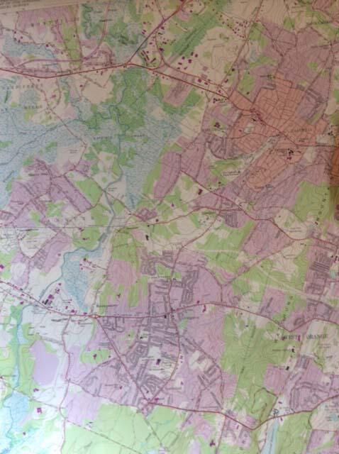
Colored map labeled: "United States; Department of the Army; Corps of Engineers" and "United States; Department of the Interior; Geological Survey." and "Caldwell Quadrangle; New Jersey; 7.5 minute series (Topographic)" and "Mapped by the Army Map Service; Edited and published by the Geological Survey; Control by USC&GS, USCE, and New Jersey Geodetic Survey; Topography from aerial photographs by photogrammetric methods; Aerial photographs taken 1942-1943. Field check 1943; Culture revised by the Geological Survey 1955; Polyconic projection. 1927 North American datum; 10,000-foot grid based on New Jersey coordinate system; 1,000-meter Universal Transverse Mercator grid ticks; zone 18, shown in blue; Red tint indicates areas in which only landmark buildings are shown; Revisions shown in purple compiled by the Geological Survey from; aerial photographs taken 1970. This information not field checked. ; Purple tint indicates extension of urban areas." and "195; Photorevised 1970" in addition to a scale reference, Road Classification, UTM grid and 1970 magnetic north declination at center of sheet. The map is clean and undamaged, except for moderate edgewear.
2019.025.003
2019.025
1970
22 in
27 in