Archive Entry
Map: 1906 Atlas of Wyoming Section
Map
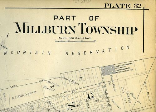
Black and white atlas map of "Part of Millburn Township." This map is plate 32 and covers downtown Millburn and the Wyoming section. Map is backed with linen; corners are bumped; edges are yellowed; there is a vertical fold in center of map; there is a circa 2 inch long stain on bottom left half and a matching stain on bottom right half; overall light soiling; edges are frayed and have a couple of nibbles; bottom of center fold has circa 1.5 inch high creases. Donor wrote in pencil on top right: "1911 Atlas," but this map appears to be from the 1906 atlas.
2008.008.001
2008.008
1906
31 in
21 in