Archive Entry
1972 Map of South Mountain Reservation
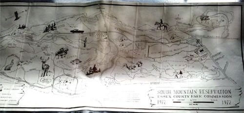
Map
1972 print of a figural map of South Mountain Reservation. Trails, shelters, picnic groves, etc. drawn on map for hikers. Bottom and top right edges have rust residue from a metal paper clip. Nine evenly-spaced vertical fold lines. Soft fold in middle, in Mylar, from storage.
2005.005.018
1972
25 in
11 in