• Skip to primary navigation
  • Skip to main content

Millburn-Short Hills Historical Society

  • About
    • Trustees
  • Explore
    • The Archive
    • The Map Room
    • The Thistle
  • Community Projects
    • Virtual Walking Tours
    • Historical Interviews
    • Special Places Reports
  • Exhibitions
    • Millburn and The Civil War
  • News
  • Become a Member
  • Donate
  • About
    • Trustees
  • Explore
    • The Archive
    • The Map Room
    • The Thistle
  • Community Projects
    • Virtual Walking Tours
    • Historical Interviews
    • Special Places Reports
  • Exhibitions
    • Millburn and The Civil War
  • News
  • Become a Member
  • Donate

Archive Entry

Archive Entry

Go back
Prev Item Next Item

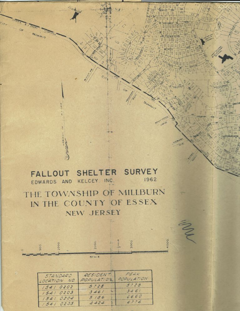
Fallout Shelter Survey Millburn, Edwards and Kelcey, 1962

Map
Fallout Shelter Survey, Edwards & Kelcey, Inc, 1962. The Township of Millburn in the County of Essex, New Jersey. The National Fallout Shelter Survey and Marking Program (NFSS) was a 1961 Kennedy Administration program that, with the help of local architect and engineering companies, located public community fallout shelters in the existing built environment. The shelter spaces were marked, stocked, and mapped. Community Shelter Plans showing the location of available shelters in the area were made with the help of local and state planning personnel. These civil defense shelters were thought to be not only essential to the survival of Americans but an important part of the United States National Defense policy. The public shelters represent a unique part of America’s Cold War history and the civilian Cold War experience.

2013.048.001

2013.048

22 in

36 in
         Fallout Shelter Survey Millburn, Edwards and Kelcey, 1962 picture number 1

PO Box 243 | Short Hills, NJ 07078 | phone: (973) 327-3258 | email: info@mshhistsoc.org PO Box 243
Short Hills, NJ 07078
phone: 973-327-3258
© 2026 The Millburn–Short Hills Historical Society | Privacy Policy
Website Designed and Developed by New Frontier, Millburn NJ